Satellite Imagery Solution Provider for UHR Capturing of Space | TelePIX
TelePIX provides outstanding satellite imagery solutions in global market. It offers a next-generation Ultra-High Resolution (UHR) multispectral EO/IR payload for government, military, intelligence, and space agencies.
TelePIX Satellite Imagery
Multispectral satellite imagery solution is the most affordable way to monitor any location on the planet. This solution goes beyond monitoring locations and capture beautiful satellite imagery in order to satisfy the need for practical data to help customers make more efficient decisions faster.
The benefits of TelePIX Satellite Imagery
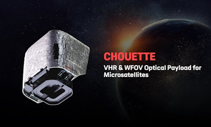
TelePIX satellite imagery is ideal for testing and developing a minimum viable product (MVP), in line with the principles of aerospace. In addition, TelePIX satellite imagery is affordable. Obtaining satellite imagery in space and operating data processing costs the fraction of a large satellite. By launching multiple Chouette into space to deliver on your business model, operational risks are considerably reduced. If a large satellite malfunctions, the whole mission would be in jeopardy.
Time to space is the next significant advantage of Chouette. In commercial world, time to market is a crucial factor. As you spend time each day developing satellite technology, you could lose valuable resources, thereby possibly frustrating investors.
The benefits listed above have direct impact on the data cost and accessibility. Earth Observation data is no more a luxury item but is quickly becoming a commodity. End-users need a lot of satellite data daily and can afford it at the lowest cost as possible. The whole data delivery process needs to be seamless and effortless.
If you are looking for satellite imagery analytics solution, you can find them at TelePIX.
Click here to contact TELEPIX.


Comments
Post a Comment